DJI Zenmuse L3 Worry Free Plus Combo (call for Deal)

(0 reviews)
Brand: DJI
In Stock ( available)
Out of Stock

or Buy Now @ per month for 12 months on EMI*

SKU:

Categories: Payloads

Brand: DJI

Share this Product

DJI's next-generation high-accuracy aerial LiDAR system features a long-range LiDAR capable of reaching up to 950 m [1] even on objects with just 10% reflectivity. Dual 100MP RGB mapping cameras and a high-precision POS system accelerate geospatial data acquisition, enabling daily coverage of up to 100 km² [2].


Hardware Performance Redefined

Zenmuse L3 integrates a 1535nm long-range LiDAR, dual 100MP RGB mapping cameras, a high-precision POS system, and a three-axis gimbal, all within a compact device, delivering unprecedented performance for its size.


1535nm Long-Range LiDAR

Long Range, Wide Coverage

Zenmuse L3 achieves a maximum detection range of 950 m [1] at a pulse rate of 100 kHz, tested under 100 klx ambient light and on objects with 10% reflectivity. The adjustable pulse rate allows for flexible power output and optimal adaptation to different operational scenarios. Typical flight altitudes of 300 to 500 m significantly [3] expand single-flight coverage and boost mapping efficiency.

Small Spot, High Energy

With a laser beam divergence of just 0.25 mrad (1/e²), the spot size at the same range is about one-fifth that of Zenmuse L2, enabling detection of smaller objects such as power lines and branches. Higher energy density results in stronger penetration capability, significantly increasing ground point density beneath vegetation and enabling high-accuracy reconstruction of complex terrains and structures.

High Pulse Rate, Multiple Returns

With maximum laser pulse emission frequency of 2 million pulses per second and support for up to 16 returns [4], Zenmuse L3 delivers highly accurate spatial reconstruction. Point cloud density and penetration capability can be adjusted to fit needs from high-accuracy mapping to complex environments.

Scanning Modes

Supports Linear, Star-Shaped, and Non-Repetitive scanning modes for different operational scenarios:
• Linear: Achieves more consistent point cloud distribution, ideal for high-accuracy terrain mapping.
• Star-Shaped: Balances accuracy with multiple scan angles and penetration capability, well-suited for forests or dense urban environments.
• Non-Repetitive: Provides multiple scan angles and broader coverage, optimized for power line inspections and other complex structural surveys.

Dual 100MP RGB Mapping Camera System

 
Equipped with dual 100MP 4/3 CMOS RGB sensors and a mechanical shutter, Zenmuse L3 delivers significantly enhanced accuracy and efficiency. Pixel binning supports an effective 25MP resolution with larger pixel size, producing superior color reproduction even under poor lighting conditions.
The dual RGB mapping cameras provide a horizontal field of view (FOV) of up to 107°, allowing each capture to cover a broader area. Even with a 20% LiDAR side overlap ratio, you can capture data for both digital orthophoto maps (DOM) and digital elevation models (DEM) in a single flight, thereby greatly improving operational efficiency.
 

Accuracy Meets Efficiency

Zenmuse L3 delivers significant improvements in both point cloud and RGB accuracy, while raising efficiency to new heights. Paired with DJI Matrice 400, a single flight can cover up to 10 km², enabling up to 100 km² of high-accuracy mapping per day [2]. Large-area, high-accuracy results are delivered in a seamless workflow.


High Accuracy

Proprietary High-Precision System
The upgraded high-precision POS system achieves heading accuracy of 0.02° and pitch accuracy of 0.01° (post-processed, 1σ). The self-developed LiDAR delivers ranging repeatability of 5 mm at 150 m (1σ) [5] and supports microsecond-level time synchronization. Each unit undergoes rigorous factory calibration to ensure consistently reliable survey results.
LiDAR Data Accuracy
Vertical accuracy is better than 3 cm at 120m altitude, better than 5 cm at 300 m, and better than 10 cm at 500 m [6], easily supporting mapping projects at 1:500, 1:1000, and 1:2000 scales. The point cloud thickness produced by Zenmuse L3 is only half that of Zenmuse L2, supporting advanced analysis and high-accuracy applications.
Photogrammetric Accuracy
With dual 100MP RGB mapping cameras, Zenmuse L3 achieves a ground sample distance (GSD) of 3 cm even at a 300m flight altitude [7]. Real-time position synchronization enables operation without ground control points (GCPs), ensuring high-quality imagery for precise mapping.

High Penetration

High Ground Point Density
With a smaller laser spot and higher single-pulse energy, Zenmuse L3 offers superior penetration capability. In terrain mapping and similar applications, it captures more ground points with greater completeness, significantly improving the accuracy and integrity of terrain data for precise surface fitting and reconstruction.

High Efficiency

 
When mounted on DJI Matrice 400, Zenmuse L3 delivers outstanding efficiency. At a flight altitude of 300 m, a single flight can cover up to 10 km², enabling up to 100 km² of daily coverage [2].
Simultaneously captures LiDAR and RGB data to generate a range of mapping products from a single flight, including DEM, DOM, and more.
 

End-To-End Solution

Zenmuse L3 seamlessly integrates with DJI's ecosystem to deliver an end-to-end mapping solution. From data acquisition and processing to application, this unified workflow is simpler to operate and easier to master than traditional multi-platform setups, helping users efficiently complete a wide range of mapping tasks.


Data Acquisition

 
DJI Pilot 2 automatically recommends flight parameters based on user-defined routes and generates a Density Profile Chart and point cloud distribution charts before takeoff, enabling users to preview point cloud results.
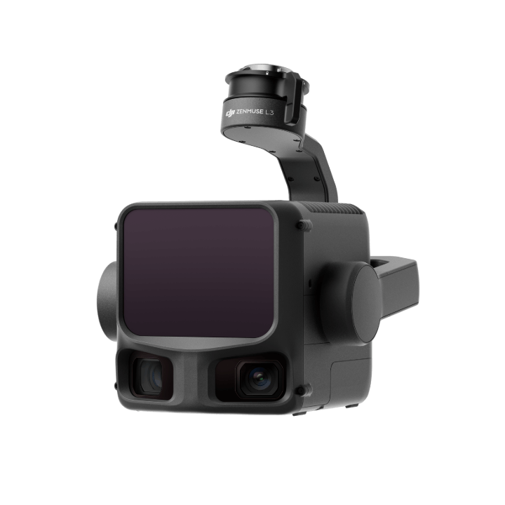
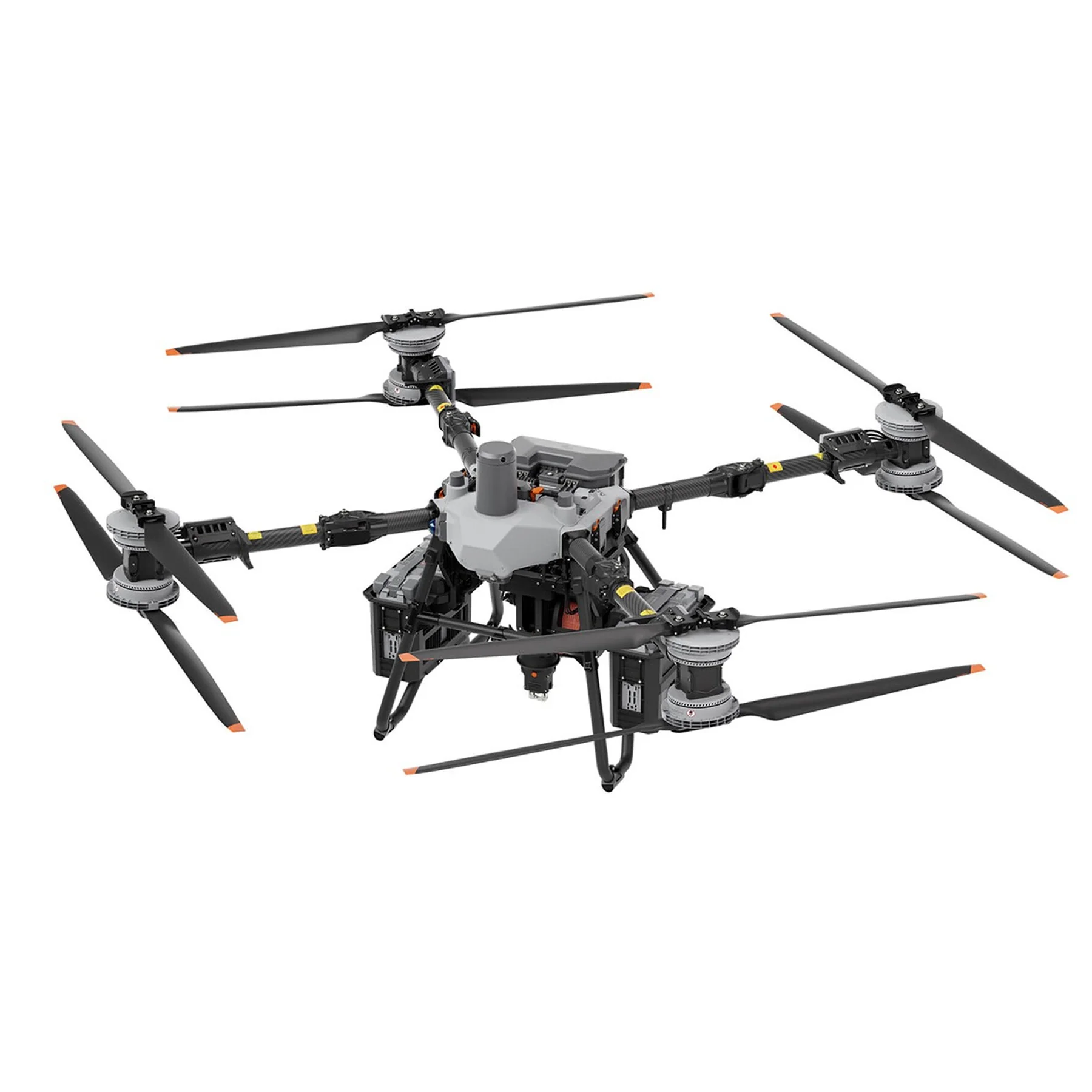
Zenmuse L3 significantly enhances Power Line Follow, supporting operations up to 130m altitude. Without bypassing obstacles or crossing lines, Zenmuse L3 enables complete electrical corridor data acquisition in a single straight flight in most scenarios.
DJI Pilot 2 supports split-screen viewing of any two data sources—point cloud, RGB, or Vision Assist—allowing users to freely combine displays to suit their needs. During Power Line Follow or when the RGB cameras face downward, Vision Assist provides real-time forward-facing visuals, reducing flight risks and improving overall efficiency and safety.
Supports real-time point cloud SLAM reconstruction with instant 2D and 3D point cloud previews during operations, allowing users to monitor progress and take measurements as data is being collected. Point cloud results can also sync instantly to the cloud via DJI FlightHub 2 for rapid emergency response and assessment.
Zenmuse L3 point cloud outputs are fully compatible with DJI FlightHub 2. Users can view and manage point cloud data in real time, easily generate detailed flight routes, annotate and share points of interest, and perform advanced line and area measurements directly in the cloud.

Data Processing

PPK Data Processing
DJI Terra features robust built-in PPK (Post-Processed Kinematic) capabilities, compatible with D-RTK 3 and standard base station data. The platform supports local PPK for RGB imagery and LiDAR, providing centimeter-level positioning accuracy even in areas with limited network connectivity or where RTK is unavailable.
LiDAR Gaussian Splatting
 
Fusion-Based Modeling
 

Data Application

Smart Filter
DJI Modify supports intelligent semantic classification of point clouds, automatically distinguishing ground, vegetation, buildings, wires, electric towers, and more. After classification, users can efficiently adjust categories using Quick Selection and Structure Selection tools, further enhancing classification accuracy and processing efficiency.
Profile Tool
 
Comprehensive Output Capabilities
 

End-To-End Solution

Delivers a complete workflow covering data capture, processing, and application.

Data Security

Zenmuse L3 supports CFexpress™ memory card encryption, enabling secure protection of stored data and preventing unauthorized access or data theft. Matrice 400 offers one-click log clearing and AES-256 encryption for video transmission, further ensuring data confidentiality.

First Year Free: DJI Care Enterprise Plus or Official Extended Warranty Service [8]


DJI Care Enterprise Plus

Comprehensive Protection | Professional Quality Assurance | Exclusive Service | Service Starts With Activation

icon

Unlimited Free Repairs

Unlimited number of free repairs within coverage

icon

Coverage for Your Whole Fleet

Shared coverage for maximum protection

icon

Free Two-Way Shipping

Hassle-free repair with free shipping both ways

icon

Expert Support

Swift response from DJI technical experts

Official Extended Warranty Service

An additional 1-year extended warranty will be provided for your product after the standard warranty period ends. Main parts are covered by official warranty service and support from professionals.

Official Service

Support provided by a professional engineering team

Quality Repair

Original parts, quality assurance


Application Scenarios

icon
See Through, Far and True
img

Zenmuse L3

Delivery Time

Inside Dhaka: 1-2 days
Outside Dhaka: 1-2 days

Shipping Charge

Inside Dhaka: ৳100
Outside Dhaka: ৳200

Warranty

DJI International 1 year warranty policy & Servicing warranty available
for all Non-Brand products

Returns

DJI International 1 Year Warranty Policy
for DJI Products

Home Shop Search Call Now
Cart